The Original Grazing School
for Women
A Fun Educational Event for Women in Agriculture
Riparian Areas on the Ranch: Protecting Creeks and Wetlands
October 7, 2026
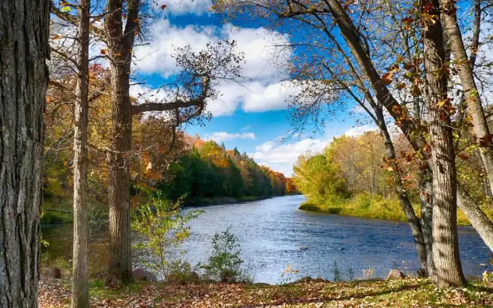
Every creek, slough and wetland on a ranch is edged by a band of greener, taller growth that behaves differently from the pasture around it. Good riparian area management treats that band as its own resource: one that filters water, holds banks together and grows more forage per acre than the uplands, yet suffers fastest when livestock camp on it. On the Prairies and in the parkland, where access to creeks and dugouts decides how much grass a herd can actually use, looking after these strips pays back in steadier banks and more reliable feed.
The green zone and what it does
Riparian areas are the transition between water and dry land: the banks and floodplains of streams, the margins of lakes and dugouts, and the wet meadows around sloughs. Moist soil supports a mix of sedges, rushes, grasses, willows and other shrubs that would not survive on the uplands a few metres away. Alberta's Cows and Fish program, which has worked with producers on grazing and riparian health since 1992, calls them the green zone.
Their deep-rooted plants hold the soil in place during spring runoff and high flows. Dense vegetation slows overland flow, traps sediment and lets rain and snowmelt soak in, so a well-vegetated creek edge stores moisture in wet years and releases it slowly into dry ones. Ducks, songbirds, amphibians, deer and fish all depend on the cover, shade and food these corridors along streams provide. For the ranch, the payoff is better water quality at the trough and forage that stays green well after upland grass has cured.
Why cattle camp along creeks
The same features that make the zone valuable make it attractive. Shade, water and green, palatable feed sit in one place, and cows will gather there, especially in late summer when temperatures climb and upland forage dries out. Researchers who tracked herds on Oregon rangeland found that cattle dispersed after drinking in cool weather but stopped leaving the creek once midsummer heat set in.
Left alone, that habit wears riparian areas down in a predictable sequence. Willow and sedge cover thins first, banks break where cattle walk in to drink, and soil erosion follows with every spring flood, carrying manure and sediment downstream and degrading fish habitat. Cows and Fish sums up the cause as grazing too many animals, too early, too long and too often, leaving plants no effective rest to regrow and store energy.
Timing is the cheapest tool
When livestock use the green zone matters as much as how many graze it. Two periods carry the most risk:
- Early spring, right after runoff. Wet ground gives way under hooves, and the pocked, lumpy surface left behind can take years to settle.
- Late summer and early fall, when creek-side plants are the only green feed left and livestock return to them repeatedly.
Grazing these pastures once soils have firmed up, or later in the season after the upland grass is used, spreads the pressure. Short grazing periods followed by real rest matter more than any single system. Where the layout allows, a cross-fence that turns the creek bottom into its own paddock lets you decide exactly when cattle go in and when they come out.
Drawing cattle away from the banks
Most riparian area management combines timing with a few practical ways of shifting where cattle spend their day:
- Off-site water. A trough fed by a solar or wind-powered pump, drawing from the creek or a fenced dugout, gives the herd clean water away from the edge. Many cattle appear to prefer it to wading in.
- Salt and mineral placement. Putting supplements well away from streams, and moving them regularly, pulls livestock onto the uplands and evens out use.
- Fencing. A corridor fence keeps cattle off the worst-hit stretch of a creek. At a dugout, a fence around most of the shoreline with one hardened, gravel-floored ramp lets the herd drink without trampling the rest of the bank. Budget for repairs, since floods and spring ice are hard on fences built this close to a channel.
- Herding and culling. Riding through regularly moves livestock off the creek. Studies in Montana found that some cows range widely up the slopes while others rarely leave the bottoms, so culling the habitual creek-bottom cows is one more option.
Weeds follow disturbance
A creek is also a delivery route for weeds. Leafy spurge seed floats, so a patch upstream can seed bars and banks further down the channel, and bare, hoof-churned mud is exactly where those seeds take root. Purple loosestrife, listed as a prohibited noxious weed in Alberta, targets wet margins and sloughs. Canada thistle and knapweed are common along Prairie waterways too. A weed-choked bank resists erosion poorly and feeds livestock less, so a summer walk to pull or spot-treat new plants costs far less than an established stand.
Checking the health of your creeks
A creek edge can look green and still be in trouble. Cows and Fish publishes riparian health assessment field workbooks for streams and small rivers and for lakes and wetlands, along with a free app, and its grazing management resources explain how rest and timing apply to these sites. An assessment looks at both vegetation and physical features: how much of the bank is covered by deep-rooted plants, whether willows and other shrubs are regenerating, how much bare or eroding ground there is, and whether invasive species are present.
A simpler habit is a set of photo points: the same spots along the creek photographed at the same time each year. Over several seasons they show whether banks are healing and shrubs are coming back, which helps ranchers judge whether ecosystem health on their land is moving in the right direction.
Rules and help before you build
Work in or beside a watercourse, such as building a crossing, can require notification or approval under Alberta's Water Act; in Saskatchewan, the Water Security Agency handles similar permits. Cost-share for protecting riparian areas with fencing and remote watering systems has been offered through provincial programs and, in a number of municipalities, through ALUS, which pays farmers and ranchers for ecosystem services on their land. Your county's agricultural fieldman can point to whatever is open locally.